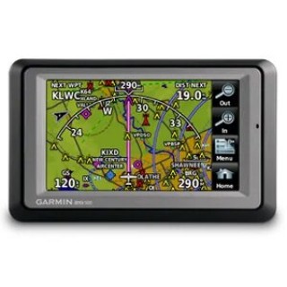
Portable GPS
Fly
confidently with our rugged, reliable, purpose-built GPS that includes our
latest in-flight features, including IFR approaches, arrivals and departures,
plus our familiar touchscreen interface.
aera 500 with Atlantic database
Go from Runways to Roadways 4.3-inch touchscreen display Fast 5 Hz GPS refresh rate Map display with terrain and obstacle warnings Street navigation with preloaded maps Aera 500 is Garmin’s first-ever touchscreen aviation GPS portable, for e..
aera 550 with Americas database
Go from Runways to Roadways 4.3-inch touchscreen display Fast 5 Hz GPS refresh rate Map display with terrain and obstacle warnings Street navigation with preloaded maps Aera 500 is Garmin’s first-ever touchscreen aviation GPS portable, for e..
aera 550 with Atlantic database
Go from Runways to Roadways 4.3-inch touchscreen display Fast 5 Hz GPS refresh rate Map display with terrain and obstacle warnings Street navigation with preloaded maps Aera 500 is Garmin’s first-ever touchscreen aviation GPS portable, for e..
aera® 660, Americas
Advanced Capabilities in a Portable Package Rugged, purpose-built portable navigator with built-in GPS/GLONASS receiver and 5-inch sunlight-readable screen Intuitive, simple touchscreen operation and single power button make getting around the displ..
aera® 660, Atlantic
Advanced Capabilities in a Portable Package Rugged, purpose-built portable navigator with built-in GPS/GLONASS receiver and 5-inch sunlight-readable screen Intuitive, simple touchscreen operation and single power button make getting around the displ..
aera® 760, GPS, Atlantic
ADVANCED PORTABLE AVIATION NAVIGATION WITH A 7” DISPLAY Fly confidently with our rugged, reliable, purpose-built GPS that includes our latest in-flight features, including IFR approaches, arrivals and departures, plus our familiar touchscreen i..
GPSMAP® 66i
Large 3” Sunlight-readable color display for easy viewing Trigger an interactive SOS to the geos 24/7 search and rescue monitoring center; two-way messaging via the 100% Global Iridium satellite network (satellite subscription required) Preload..
GPSMAP® 86i
Water-resistant, floating design, sunlight-visible 3” display and button operation provide ease of use on the water Stream boat data from compatible chartplotters and instruments to consolidate your marine system information Stay in touch from ..
GPSMAP® 86s
Water-resistant, floating design, sunlight-visible 3” display and button operation provide ease of use on the water Stream boat data from compatible chartplotters and instruments to consolidate your marine system information Functions as a remo..
 Logo.png)


